By Chris Bowen & Chris Tetley
Chris B: The Northern Traverse, organised by Ourea Events, follows Alfred Wainwright’s Coast to Coast path across the breadth of England, from St Bees to Robin Hood’s Bay. I first did the Coast to Coast with Dave in 1975 – the summer after my ‘A’ levels. It took two weeks, and I found it very tough. I had a big, framed rucksack and was wearing leather walking boots. When I realised that it would be 50 years ago this year since I’d done this as my first multi-day walk, I thought that doing the route again would be a nice idea. I talked to Chris T. who has been my partner in crime on other ultras and we agreed to enter.
Chris T: The race is continuous with support points along the way where there is food, lovely volunteers who can’t do enough for you, and medics if needed. At some of the support points you have access to a drop bag and can have a bit of sleep (if you are lucky) in a shared tent.
If we managed to finish it in the time allowed (a good bit less than 5 days) it would be a really big achievement, especially as we are both almost 68 and would be amongst the oldest competitors.
The Start
Helen had driven us to the start and registration at St Bees School. Having arrived a little early for the kit check at 5pm and as the school was quiet, we went hunting for a café to kill a little time. We had heard a few stories of how they are quite strict at kit check – even on the way in there were those coming out saying similar things. We presented our photo ID and were called forward. Despite the rumours, kit check wasn’t too bad, collect number, get tracker fitted and pick up hoody. At this point you can leave your drop bag for onward travel. The bags were popped on the scales and weighed. That’s it all sorted so now for food, sleep and final preps at our Premier Inn in Whitehaven.
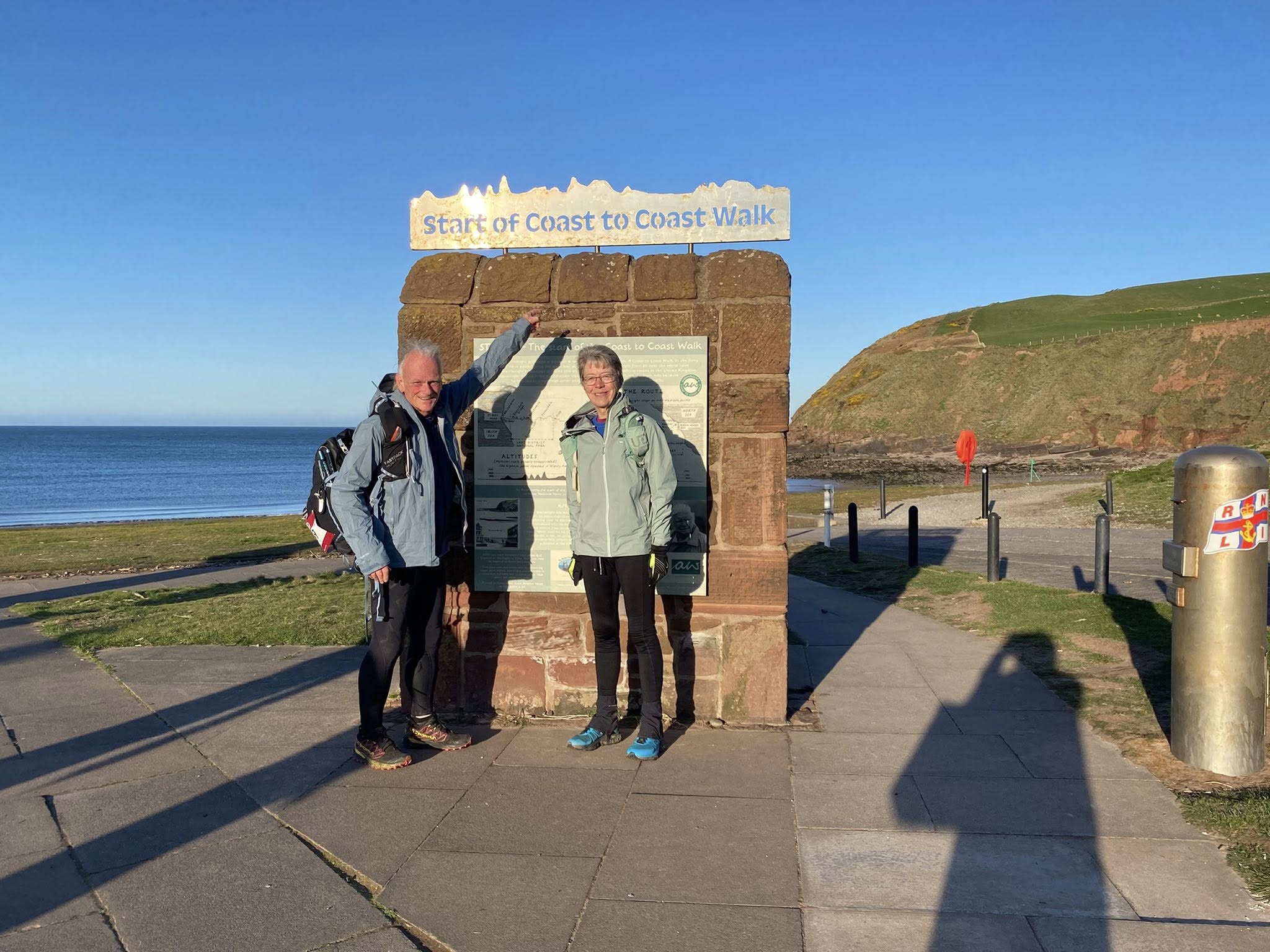
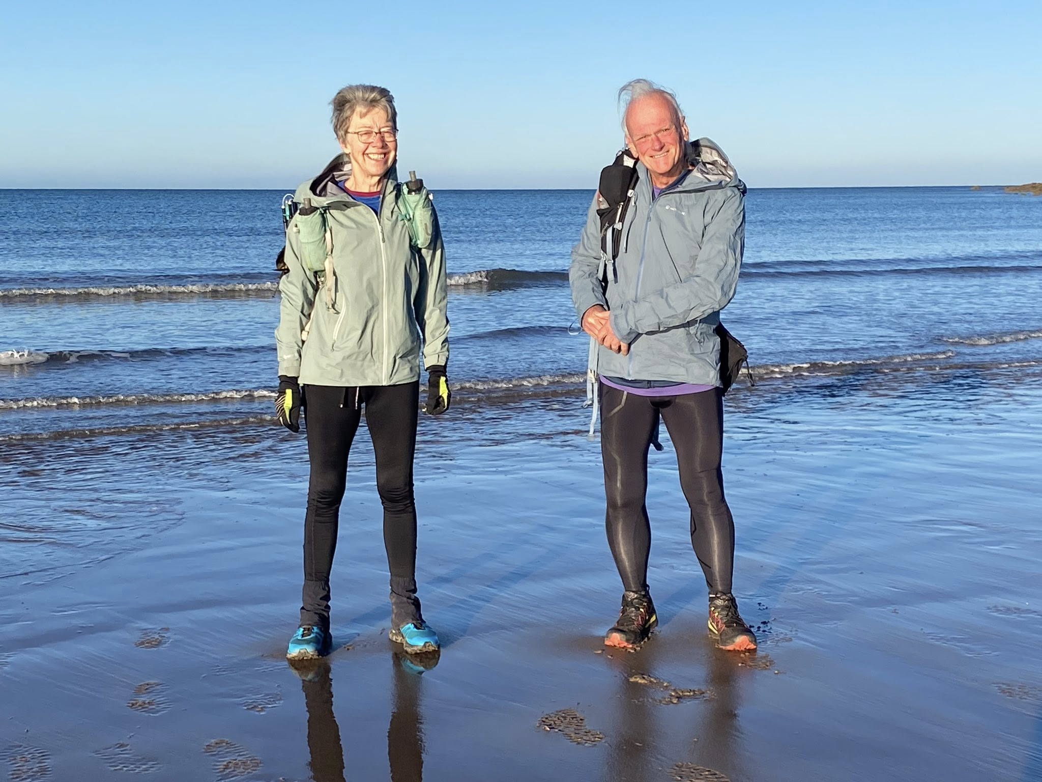
Saturday morning all preparations done and off to St Bees. This time to the seafront. Crowds of people are beginning to mill around the start area. First objective, we go and collect a small pebble and dip shoe in the sea. The obligatory photo by the official start sign of the C2C route and we are ready.
And We Are OFF
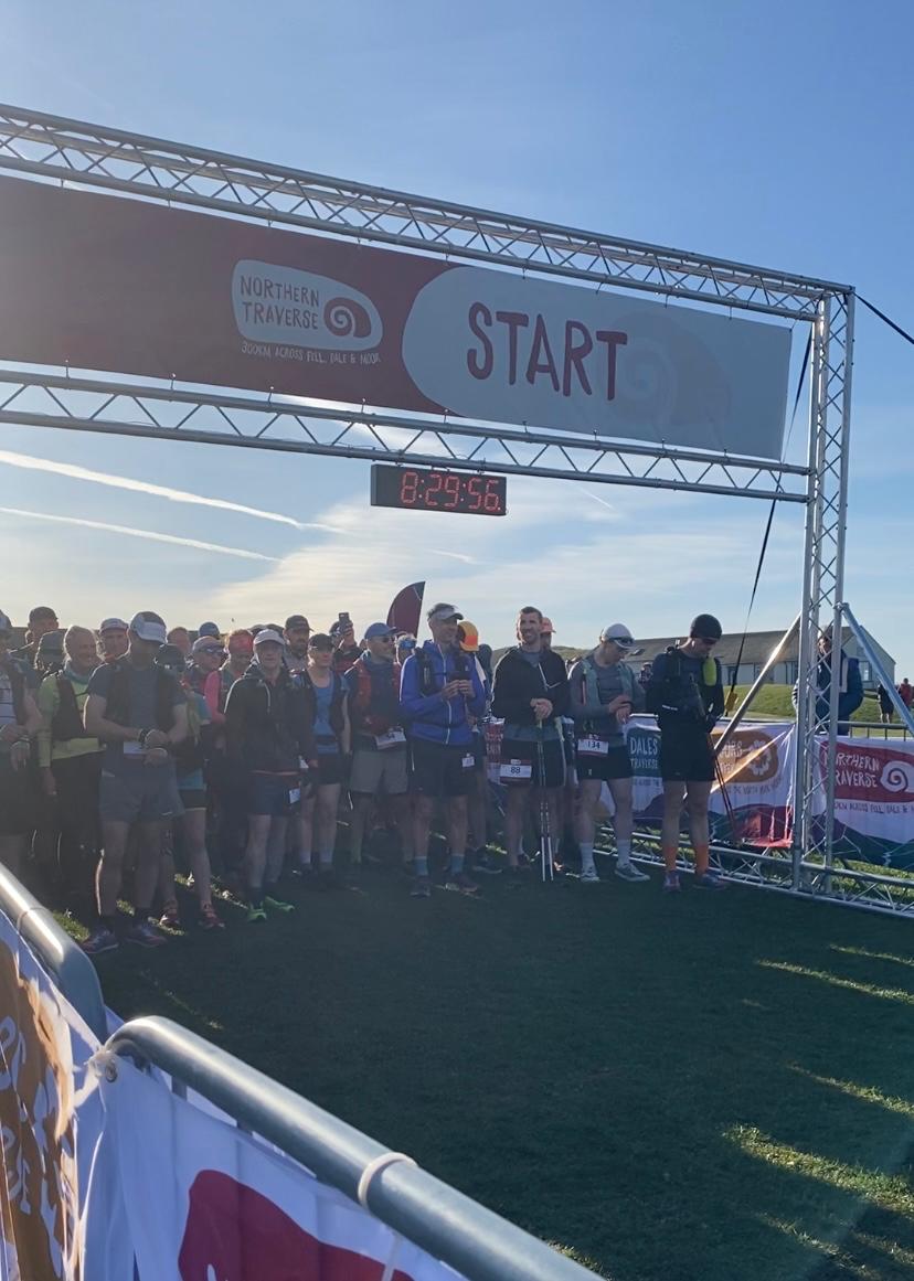
It wasn’t long before we started to assemble in the start funnel. The sun was shining bright and its time we were off up onto the cliff top path to St Bees Head. Soon, we begin to turn inland and, in the distance, can be seen the Lake District fells ahead of us.
St Bees to Ennerdale (15 miles 482m ascent)
The first bit however is flat, a mix of farm tracks fields, roads and old railway lines as we head towards Cleator Moor. Now saying this section was flat, well we now go round a hill called Flat Fell…. Yes, there is one before heading down to Ennerdale Bridge and our first support point along the route. Here water is provided, nothing more. However, there is a café next door. Something I didn’t do here, and should have done, was EAT! We had a coffee and ice cream.
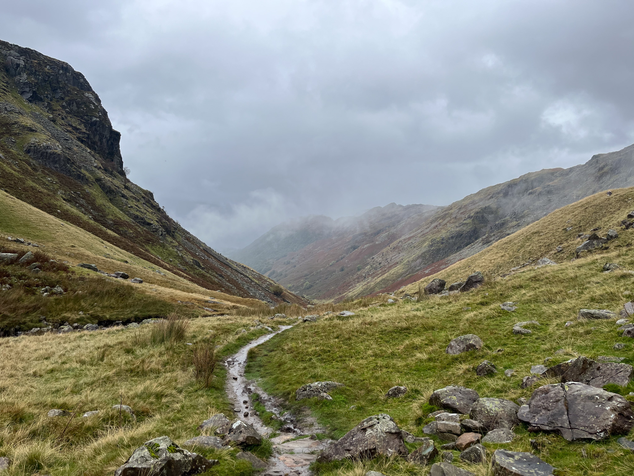
Ennerdale to Rosthwaite (15 miles 525m ascent)
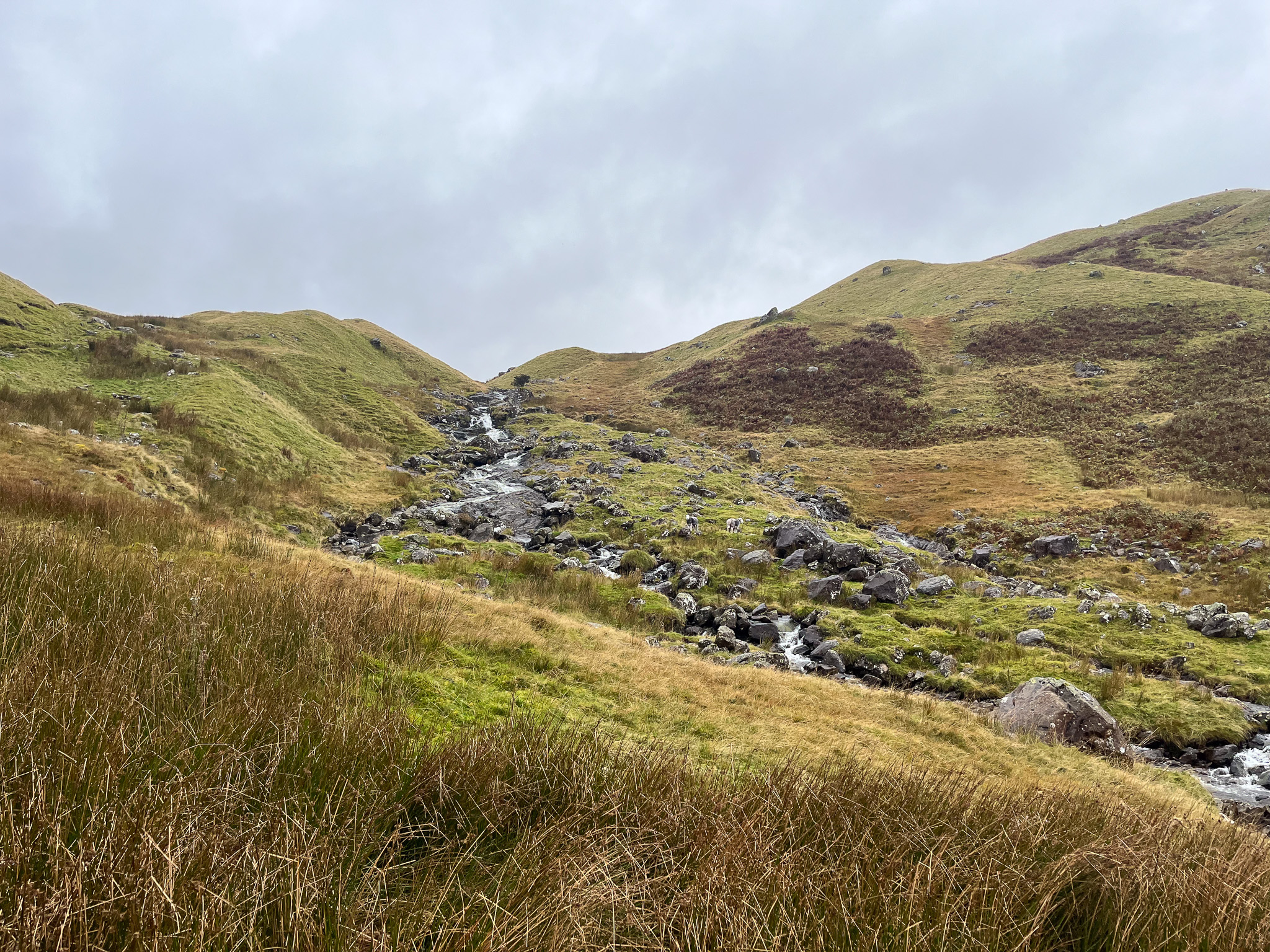
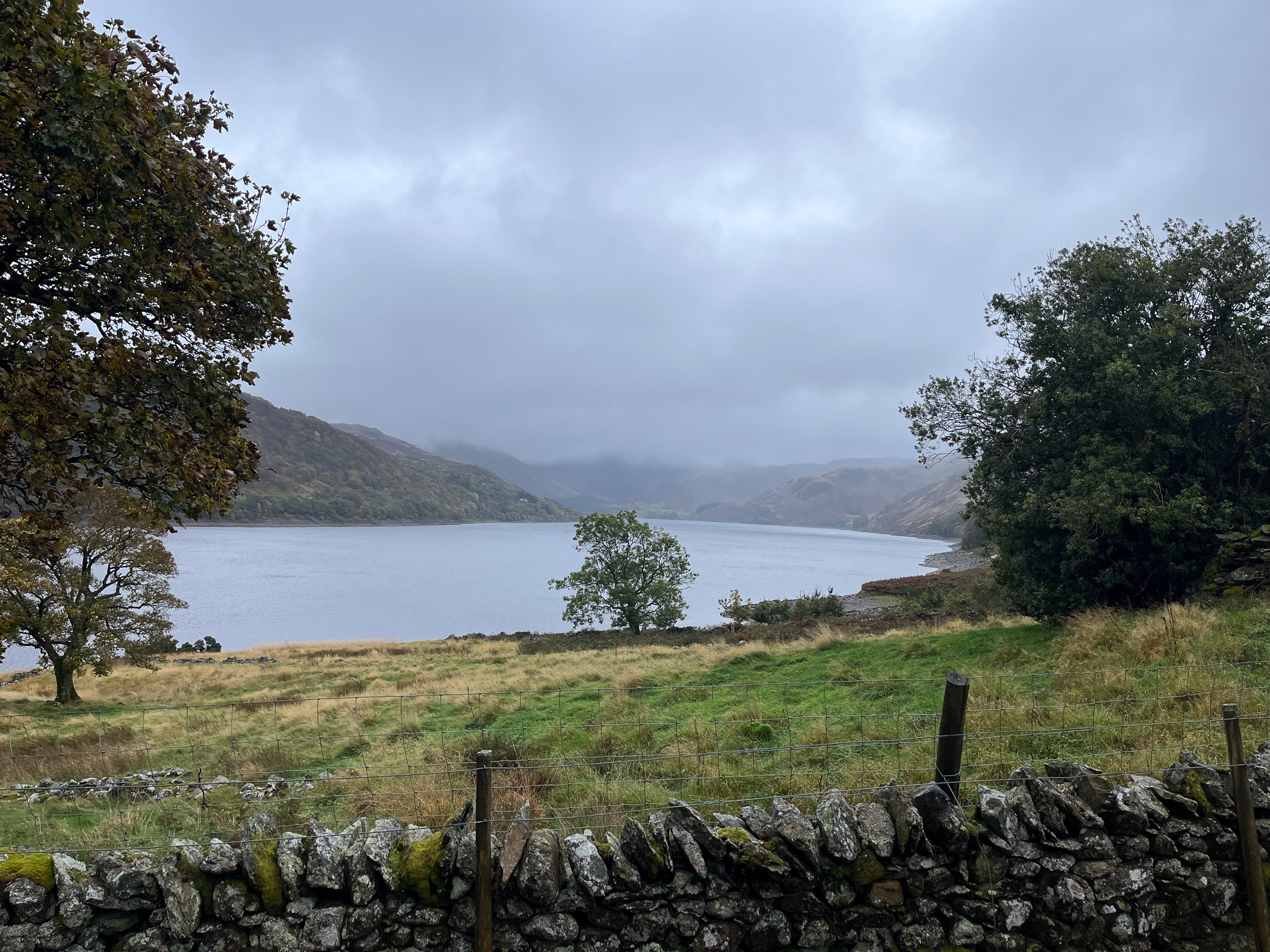
After Ennerdale Bridge it’s a short, wooded section to the lake. The path starts quite good along the southern edge. But soon becomes very undulating and rocky and at times quite slow going. At Lakes end you are now definitely in the Lake district fells. Tall hills to the left and right. Crossing the valley floor its now an easy path to Black Sail. Here there is a small kitchen with a few essentials, kettle too. A small charge via an honesty box.
Soon after Black Sail begins the first of the really steep climbs up Loft Beck, once at the top still climbing passing between Haystacks and Grey Knotts. This was now mid-afternoon, and the day was at its hottest – it was very hot. Continuing along in front of us we began to see the machinery of Honister Mine on the Hillside. Descending the old tramway, we arrived at the Honister slate mine. Sadly, the café here had closed for the day.
Downhill, passing by Seatoller, we came to an unusual section where you scramble over a rocky rivers edge by holding on to a chain. Different! Passing through the Youth Hostel grounds to Rosthwaite Village Hall and another very welcome support point. Food and drink all available but no drop bag here. Time for a short rest before heading out into the evening and the next big hill.
Rosthwaite to Patterdale (14 miles 1015m ascent
Following Stonethwaite Beck the light was by now beginning to fade, the gradient becoming steeper and steeper until we got to the near vertical scramble of Lining Crag. This is a very steep craggy section with a poorly defined path on the way up. It was fully dark by now which made it trickier. Luckily its only short and soon we are on the top of Greenup Edge.
We now began the steady descent down along a much easier path heading into Easdale. The temperature was now beginning to drop, becoming quite cold. Further down Easdale the lights of Grasmere were to be seen ahead.
We don’t fully reach Grasmere but turn left to begin the third big climb of the day. It’s now approaching midnight and ahead of us can be seen the lights of fellow runners as we climb at the side of Tongue Gill. This too has some quite steep sections up to Hause Gap between Seat Sandal and Fairfield. Once over the top we pass by Grizedale Tarn and begin the descent. This one is shorter, and I suppose the knowledge that once down we would be arriving at the first checkpoint kept us pressing on. Passing through Grizedale Forest and then past the Ruthwaite Climbing hut the journey continued in a mainly downward direction (Yippee).
Paths become tracks, tracks become roads, eventually tarmac and we are here in Patterdale.
Located in the school grounds, this is the first proper checkpoint, so we have access to our drop bags, The priority now was sleep. Berth allocated, all extra layers on in our sleeping bags; we were in a tent outside! It was Cold, Very Cold! Think it’s fair to say that sleep was minimal at best. Noise from a heater, the cold, and people just milling around. We had allowed ourselves 3 hours sleep – still rest is better than nothing. Once back in the main tent we picked a spot nearer the cooking area, away from the draughty doorway to put things away back in bag. Change clothes, have breakfast. Prepare feet, change shoes. Then it was off out again. It was now daylight.
Patterdale to Shap (15 miles, 950m ascent)
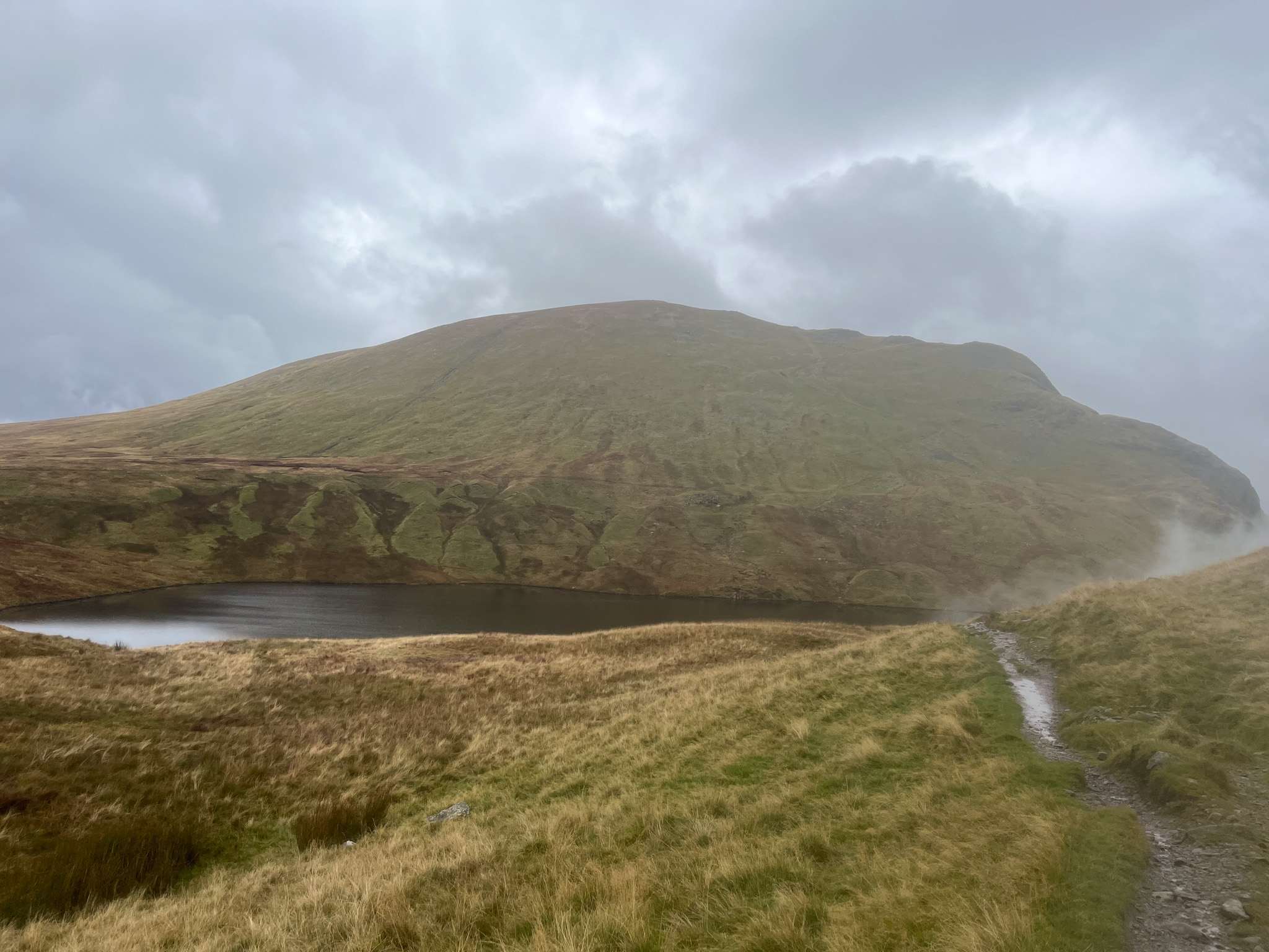
The prospect of another nice day lay ahead of us. We were about to do the last of the Lakeland big hills, Kidsty Pike. This one doesn’t seem as bad it’s a steady climb up the hillside before we turn towards Angle Tarn. There were lots of people wild camping up there. Bet they were cold overnight! Up to the top where we reflected on how bad the weather was last time; we were here on the recce last October. This time it was glorious sunshine as we summitted Kidsty, the highest point on the whole route, over the top then it’s a very sharp descent to Haweswater.
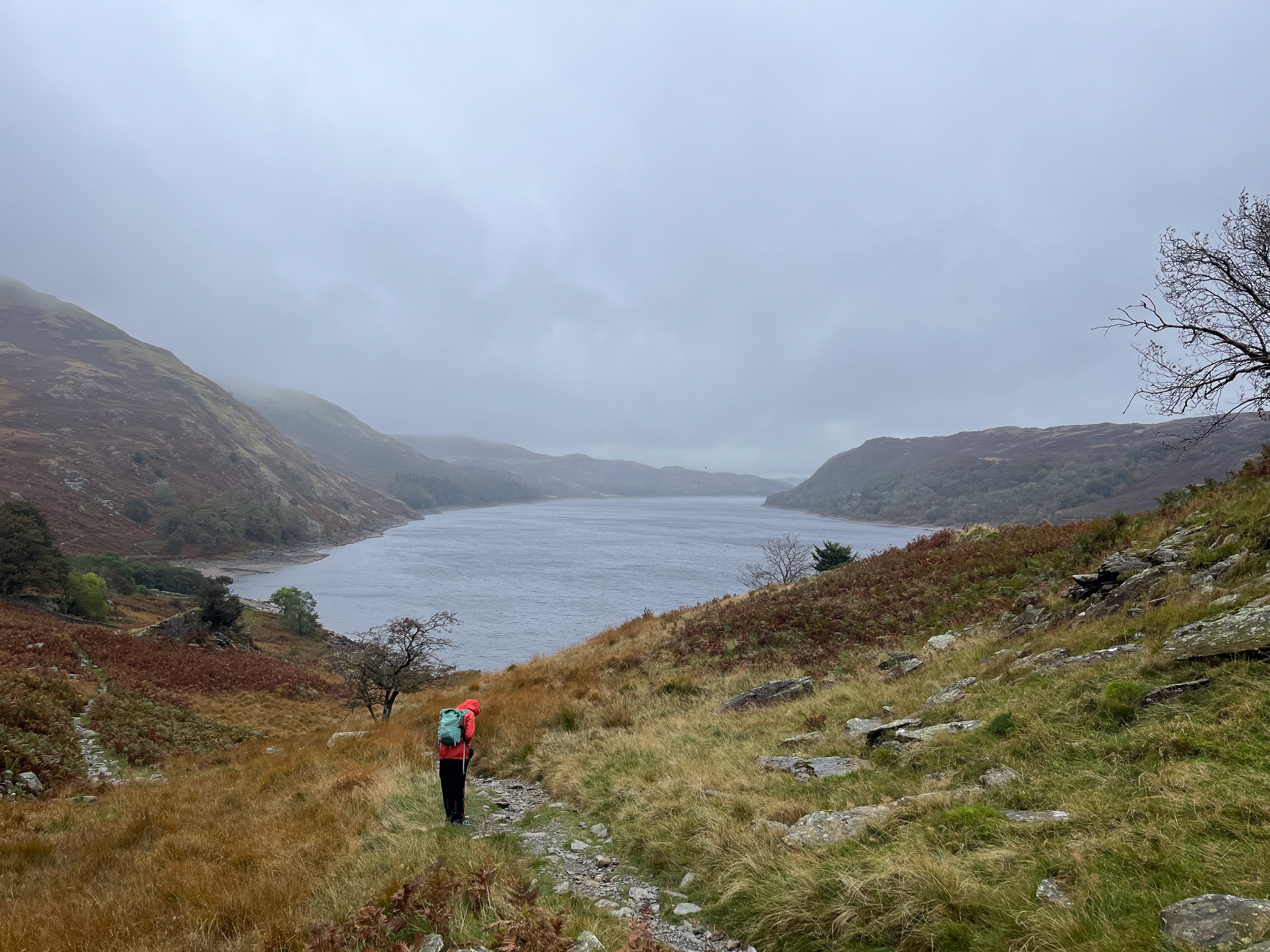
Once down we follow the side of the reservoir for what seems an eternity. Just like Ennerdale Water, it’s not flat so there is still some climbing to do, eventually reaching the end and the first habitation in a while. Here in Burnbanks is a small tuck shop/cold box with some flapjack and drinks available (cold). After a pause it was on across fields and tracks to Shap Abbey and Shap support point for food – no drop bags this time.
Shap to Kirkby Steven (19 miles 418m ascent)
From here to the next checkpoint is 19 miles, not too far really. One of our fellow run/walkers decided to call for a Guinness before leaving Shap! No, we weren’t tempted this time. It was late in the afternoon by now and we needed to press on. It’s worth mentioning that on this stretch we noticed the shiny new finger posts were quite inconsistent, at least when it came to miles marked on them. So, the distances went down but only by a little but then they went down a lot and after that not so much. I (Chris T) had also at this point had a problem with my watch Navigation app: (somewhat annoying) but I had to learn to live with it.
This section is just bumpy, and progress was beginning to slow. It was proving another long day. Don’t suppose the featureless cold dark moors which seemed to go on forever helped. I was beginning to fall asleep on my feet, but there were still a few miles to do to get to Kirkby Stephen. Tantalising lights in the distance of some habitation but not there yet. Getting stuck the wrong side of a wall near an old farmhouse all added to the long remaining miles. Finally, we begin to drop off the moor and into the town. The support point is in the school here. So, we follow the route and walk all the way right round to the back of the building. This time we are inside …. Warm and suitably refreshed, we again go to get some sleep. The staff apologised that the tents which were erected in an unheated sports hall. But they were inside. Much warmer than last night, luxury. I We had a few hours’ sleep (probably 3-4).
Kirkby Steven to Reeth (Nearly) (32 miles 1068m ascent)
I woke up feeling much better, Breakfast was porridge, and some scrambled egg. Tea, of course. Chris B was still in bed. I texted, messaged, one of the staff was going to see where she was and then she appeared …. Slept in! we were looking forward to an easier day ahead. Only 30 miles to Richmond.
At just on first light we set off up the hill to the Nine Standards. It was a glorious morning, and we were making good progress.
The stone slab flagging of Nine Standards is still very much work in progress. Piles of slabs waiting to be laid. New bridges mainly over the deeper groughs, two diggers on the hillside but I understand that work had paused due to ground nesting bird season. Having said that, the piles of slabs, the new bridges and the fact that the weather was incredibly dry meant that what should have been a bog fest wasn’t. Plus, what remained of the boggy bits were still frozen because of overnight frost.
Eventually we came off the moors and arrived at the head of Swaledale. It was from here the wheels began to properly come off the bus for me. The food I had for breakfast had clearly run out and not I’m sure what I was thinking of. In my head it was a nice easy trot down easy valley paths to Reeth. No. Here the C2C splits to low level and high level. We do the high-level route up and over the moors past the old lead mine workings. It’s an interesting area but it goes up, then down, then up again. It was across one of the moor tops that I had a wander off the path again due to lack of sleep or energy, take your pick. Following yet another steep down and up and then the prospect of another steep scramble coupled with the fact that we were losing ground timewise, a decision was looming. Not a decision I have had to take before, and it was hard. I was not really feeling hill-safe anymore. Its OK wandering off a nice path, but not on a steep scramble. I had a sit down and had to have the discussion with Chris B. In reality my time was up. A quickly planned exit strategy down to Gunnerside following the river was my way off the hill.
I spent the next hour on my way down telling myself that I really had no option. The tiredness was probably brought on not being able to eat. Lots of high energy bars with me, but I couldn’t eat any of them. A nightmare! I never have been able to fully resolve my fuel intake in hot weather. Once depleted it takes a lot of catching up. My feet were fine, my fitness was fine, but there was nothing left in the fuel tank.
To say I was gutted was an understatement. Once down the hill I was met by two Safety Team personnel who were heading out to find me. I was nearly at Gunnerside. They were very sympathetic and said I had absolutely made the right decision. When I arrived at their van I had done 99.95 miles. They said I couldn’t leave it there and made me walk round the van to push it over a hundred.
I was then taken to the next checkpoint at Richmond. The staff there were also very sympathetic. I was even given a hug by one of the helpers there I knew from my time on the Spine. So, something to eat and drink, and I was falling asleep at the table, so I was encouraged to go to bed in one of the tents. Might as well as I was waiting to be picked up by Helen.
I had completed 100 miles and over 17,200 ft (5250m) of climbing.
Meanwhile I last saw Chris B scrambling up the steep climb to yet another moor. She phoned in my intentions to race HQ. It was then an easy down to Reeth. Could I have made it? Possibly but at what cost? It took best part of a week for things to get back to some semblance of normal.
Reeth to Richmond (10 miles 314m ascent)
Chris B: I was sure in my mind that Chris T had made the right decision. We’d always had an agreement that if one of us dropped out, the other would continue if they could. I had sore feet but apart from that I was fine, and I knew that I could make up a bit of time. At the point when Chris decided to retire and descend to the valley, there was no phone signal, so the most important thing was for me to get to a point where I could phone Race Control and explain what was going on. I climbed up to a cairn where there was a signal and talked to a lovely lady who told me they would send out the safety team to meet Chris at Gunnerside.
Thankfully from this point, the track down to Reeth was good and I was able to run and make it to the Dales Bike Centre café before it closed, enjoying tea, cake and a can of coke. It was here that I caught up with Bev and Richard who had been running together for a while and who immediately said they were happy for me to join them. They set off before me, but I soon caught them, and we continued together. I was wearing shorts and a T-shirt, but the temperature dropped once again to around freezing and we needed to put on several more layers as we descended to the Richmond support point with access to our drop bags. I ate some mac n’ cheese, had my feet attended to (strangely, by a member of Buxton MRT) and got into my sleeping bag for a couple of hours sleep. I was so glad that I had taken my 4-season sleeping bag and a good Therm-A-Rest as the tents were very cold. I did sleep however and got up again at 2am to have more attention to my feet, more food and more re-packing.
Richmond to Lordstones (31 miles, 850m ascent)
This section goes through the Vale of York and is much flatter than the previous sections. It involves a lot of road sections interspersed with hard track which proved to be hard on the feet in the warm daytime weather. Setting off in the dark at 4am with Richard and Bev, we followed the river Swale out of Richmond to a footbridge over the A1. We then continued on roads and tracks: fast walking and a little bit of jogging (or ultra shuffling) remembering to eat every time I felt a little bit hungry. We eventually arrived at Danby Wiske, where a lovely man walking the Coast to Coast told us it was worth diverting 200m off the route to a campsite with an honesty box and hot drinks and that the owner would make bacon sandwiches if asked. We were so glad that we took his advice – he even accompanied us to show us where things were. True to his word the lady made me hot egg sandwiches, we had several cups of coffee, and she charged us £4! And I was able to put more tape on my little toes! Fortified for the next few miles, we progressed to the A19 road crossing. This is a notoriously fast road and has a reputation for being difficult to cross. I arrived just in front of the other two and caught up with Luke and Sarah who had been into a nearby petrol station and had more real food in their hands. I decided more food was needed and stocked up. In the event it wasn’t too difficult to cross the road via the central reservation and we started the climb up onto the Yorkshire Moors. The climb was fine but the descent into the Lordstones support point was painful. We arrived about 5pm, had some food and I got into my sleeping bag for an hour and a half sleep knowing that I had only 40 miles left to do and that I was likely to be able to finish even though I would have to go right through the night!
Lordstones to Robin Hood’s Bay (41 miles1472m ascent)
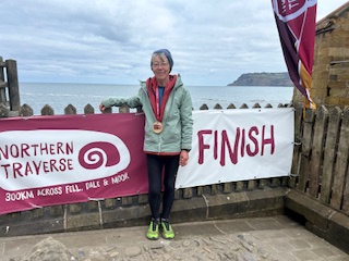
Bev, Richard and I left Lordstones just after 9pm and began the first of four ups and downs onto the North York Moors proper. The descents between were like going down Jacob’s Ladder near Edale except longer – no fun with sore feet. We found our way through the Wain Stones, which involved a bit of scrambling, and soon reached the old railway which goes on and on and on, especially in the dark. Everything eventually passes though, and then we were on bits of roads and hard stony tracks to the Glaisdale support point at the half way point about 20 miles into this last stage, arriving about 6am just as it was getting light. I was very sleepy and was even nodding off when I was having one of my big toenails lanced by the medic as it had fluid underneath it and had been agony for the last few miles. I ate, drank several cups of tea and coffee, and had half an hour’s nap across three chairs. A few minutes after 8am we set off again through a few villages and our final climb of the whole route. Soon after we arrived at the Falling Foss café, which was very busy, but I really needed more proper food. I queued up with Richard and saw the most amazing bacon sandwiches being served on ciabatta bread. Now I don’t eat meat, but the veggie choice was a small vegetable tart which would not hit the spot. I went for a BLT. It was the best thing! We now only had 10 miles to go – we could see Whitby Abbey in the distance and after arriving at the coast we had a few miles south to go along the clifftop and then a descent through the town to the finish line on the seafront at Robin Hood’s Bay. I was met by Dave, Gwynne and members of the Ourea event team.
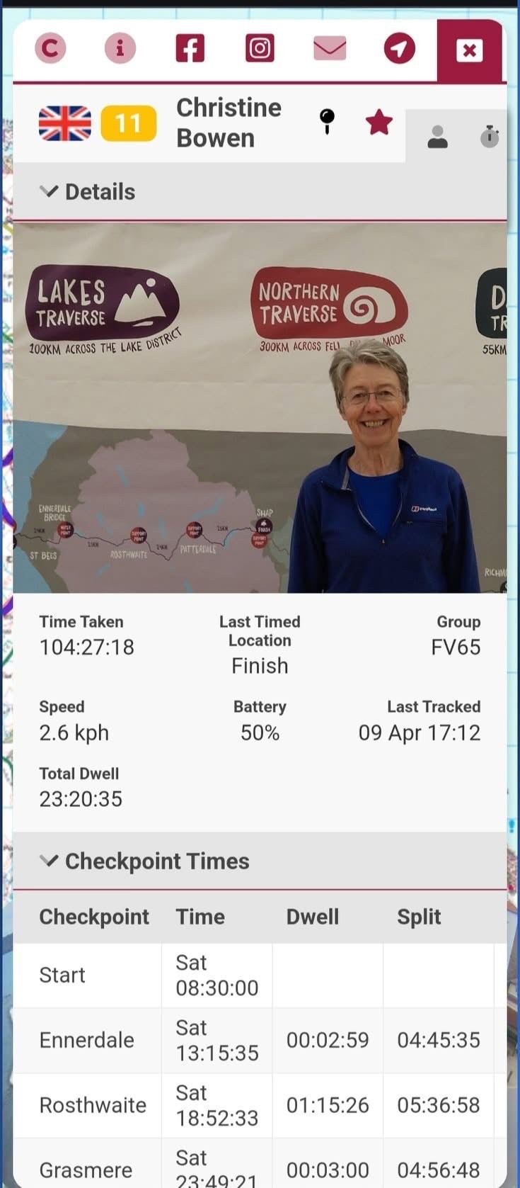
It had taken 106 hours 27 minutes, and I was the oldest person to finish, of which I am very proud! I was presented with my (wooden) medal and I remembered to cast my little pebble into the sea!